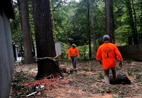
Services > Land Surveying
Surveying
At Brighton and Hove Landmark Assessments, we specialize in land surveying—a precise science essential for defining the terrestrial positions, boundaries, and topography that underpin safe and legally sound property development.
Land surveying is far more than just measuring distances; it involves determining the two-dimensional and three-dimensional positions of points on the Earth’s surface, establishing accurate maps, and resolving boundary ambiguities that could lead to disputes or costly errors. In Brighton and Hove, where historic properties, coastal terrain, and modern developments intersect, overlooked boundaries or inaccurate terrain data can jeopardize construction projects, property sales, or compliance with local regulations.

Land Surveyor
Our RICS-accredited surveyors combine cutting-edge technology—such as 3D laser scanning, GPS, and drone mapping—with decades of expertise to deliver meticulous boundary delineation, elevation mapping, and subsurface feature analysis.
Whether you’re planning a new build, resolving a land dispute, or restoring a heritage site, we ensure every measurement aligns with UK legal standards and environmental requirements. By partnering with us, you gain clarity on your land’s true potential, avoid legal pitfalls, and lay a foundation for projects built on precision.

Land Measurement
Land measurement serves as the backbone of informed decision-making in property development, offering precise spatial data that defines everything from plot dimensions to elevation gradients. In areas where historical preservation and modern development intersect, techniques like LiDAR scanning and theodolite angle measurement capture intricate details of the land’s contours and features. This data is vital for applications such as boundary demarcation in heritage sites or ensuring land registry compliance for eco-friendly developments.
Beyond resolving ownership disputes, accurate measurement supports sustainable urban planning—whether balancing flood resilience in vulnerable zones or optimizing green spaces in densely populated areas. At Brighton and Hove Landmark Assessments, we blend traditional tools with satellite-based geospatial systems to deliver insights that drive compliant, cost-effective projects. From residential extensions to large-scale infrastructure, our surveys transform raw terrain data into actionable strategies, ensuring every development aligns with regulatory standards and your vision.
Services > Land Surveying

Land Surveying
At Brighton and Hove Landmark Assessments, we specialize in land surveying—a precise science essential for defining the terrestrial positions, boundaries, and topography that underpin safe and legally sound property development.
Land surveying is far more than just measuring distances; it involves determining the two-dimensional and three-dimensional positions of points on the Earth’s surface, establishing accurate maps, and resolving boundary ambiguities that could lead to disputes or costly errors. In Brighton and Hove, where historic properties, coastal terrain, and modern developments intersect, overlooked boundaries or inaccurate terrain data can jeopardize construction projects, property sales, or compliance with local regulations.
Land Surveyor
Our RICS-accredited surveyors combine cutting-edge technology—such as 3D laser scanning, GPS, and drone mapping—with decades of expertise to deliver meticulous boundary delineation, elevation mapping, and subsurface feature analysis.
Whether you’re planning a new build, resolving a land dispute, or restoring a heritage site, we ensure every measurement aligns with UK legal standards and environmental requirements. By partnering with us, you gain clarity on your land’s true potential, avoid legal pitfalls, and lay a foundation for projects built on precision.

Land Measurement
Land measurement serves as the backbone of informed decision-making in property development, offering precise spatial data that defines everything from plot dimensions to elevation gradients. In areas where historical preservation and modern development intersect, techniques like LiDAR scanning and theodolite angle measurement capture intricate details of the land’s contours and features. This data is vital for applications such as boundary demarcation in heritage sites or ensuring land registry compliance for eco-friendly developments.
Beyond resolving ownership disputes, accurate measurement supports sustainable urban planning—whether balancing flood resilience in vulnerable zones or optimizing green spaces in densely populated areas. At Brighton and Hove Landmark Assessments, we blend traditional tools with satellite-based geospatial systems to deliver insights that drive compliant, cost-effective projects. From residential extensions to large-scale infrastructure, our surveys transform raw terrain data into actionable strategies, ensuring every development aligns with regulatory standards and your vision.


GPS Land Surveying
GPS surveying has revolutionized the land surveying industry by enabling rapid, high-precision measurements of terrestrial positions, boundaries, and elevations. Using satellite-based Global Positioning Systems (GPS), surveyors can pinpoint locations with centimeter-level accuracy, even in challenging environments like dense urban centers or undulating rural landscapes. Unlike traditional methods, GPS technology eliminates the need for labor-intensive line-of-sight measurements, streamlining tasks such as boundary demarcation, topographic mapping, and construction site layouts.
Real-Time Kinematic (RTK) GPS systems further enhance efficiency by delivering instant data corrections, ensuring reliability for projects ranging from resolving property disputes to planning sustainable infrastructure. This blend of speed and precision makes GPS surveying indispensable for modern developments, where tight timelines and regulatory compliance demand flawless data.
Distance Measurement
Long before the advent of electronic tools, land surveyors relied on ingenious yet labor-intensive methods to measure distances. Indigenous peoples in pre-colonial America, for example, used the "bow shot" — the distance an arrow could travel — as a rough unit of measurement. In Europe, surveyors employed steel chains like the Gunter’s chain or invar tapes, meticulously pulling them taut to minimize sagging and adjusting for heat expansion to maintain accuracy.
Measuring slopes required "breaking" chains into smaller increments, while perambulators (measuring wheels) provided rough estimates for longer distances over uneven terrain. For particularly challenging landscapes, tacheometry offered a workaround by calculating distances through angular measurements of objects with known sizes. Though innovative for their time, these methods were prone to human error, environmental interference, and inefficiency, making tasks like mapping Brighton’s undulating South Downs or resolving boundary disputes in Hove’s historic districts painstakingly slow.
Today, Brighton and Hove Landmark Assessments leverages cutting-edge Electronic Distance Measurement (EDM) and laser technology to deliver unparalleled precision in land surveys. Modern EDM devices use lasers or infrared waves to measure distances instantaneously, eliminating the need for manual chains or angular calculations. This technology captures millimeter-level accuracy, even across Brighton’s coastal slopes or dense urban areas, while automatically compensating for environmental factors like temperature. Combined with GPS and 3D mapping tools, EDM streamlines tasks such as boundary demarcation in Rottingdean, topographic surveys for flood-prone zones in Pevensey, or construction layouts in Kemp Town’s heritage sites.
Need to get in touch?
Surveying Services
Free Estimate In 3 Easy Steps

Request a Free Quote
Request a free estimate by either calling our friendly dispatch center, open 24 hours at , or complete our short quote request form to have one of our estimators contact you to schedule a time to survey the job.
![[keyword]](https://assets.cdn.filesafe.space/qNVdBNGGVRuhVkEpK5R0/media/c971b9a9-582e-48cd-9ab2-92b82e49b31c.png)
Receive a Written Estimate
After the job is surveyed, you will receive a written estimate via text outlining the job details and the cost. Just reply back with your acceptance and we'll contact you to schedule the job to be completed when it is convenient for you.

![[keyword]](https://assets.cdn.filesafe.space/qNVdBNGGVRuhVkEpK5R0/media/90805641-45a0-49fe-8e56-e15540b02af6.png)
Get Your Land Survey Done!
Our crew of professionals will show up on the scheduled date and time to complete your job, cleanup the debris, and leave your yard looking better than ever!
Free Estimate
In 3 Easy Steps
Request a Free Quote
Request a free estimate by either calling our friendly dispatch center, open 24 hours at , or complete our short quote request form to have one of our estimators contact you to schedule a time to survey the job.
![[keyword]](https://assets.cdn.filesafe.space/qNVdBNGGVRuhVkEpK5R0/media/e08b08fe-a284-4975-bb21-ab72630481c6.png)
Receive a Written Estimate
After the job is surveyed, you will receive a written estimate via text outlining the job details and the cost. Just reply back with your acceptance and we'll contact you to schedule the job to be completed when it is convenient for you.
![[keyword]](https://assets.cdn.filesafe.space/qNVdBNGGVRuhVkEpK5R0/media/4b92aff0-1f46-4ead-879b-14b7d9ea5cc4.png)
Get Your Survey Done!
Our crew of professionals will show up on the scheduled date and time to complete your job, cleanup the debris, and leave your yard looking better than ever!
East Sussex Service Area
GPS Land Surveying
GPS surveying has revolutionized the land surveying industry by enabling rapid, high-precision measurements of terrestrial positions, boundaries, and elevations. Using satellite-based Global Positioning Systems (GPS), surveyors can pinpoint locations with centimeter-level accuracy, even in challenging environments like dense urban centers or undulating rural landscapes. Unlike traditional methods, GPS technology eliminates the need for labor-intensive line-of-sight measurements, streamlining tasks such as boundary demarcation, topographic mapping, and construction site layouts. Real-Time Kinematic (RTK) GPS systems further enhance efficiency by delivering instant data corrections, ensuring reliability for projects ranging from resolving property disputes to planning sustainable infrastructure. This blend of speed and precision makes GPS surveying indispensable for modern developments, where tight timelines and regulatory compliance demand flawless data.
GPS surveying addresses unique challenges in balancing heritage preservation with contemporary growth. For example, mapping historic boundaries in protected terraces requires pinpoint accuracy to avoid encroaching on listed structures, while coastal projects rely on GPS to monitor erosion and plan resilient infrastructure. At Brighton and Hove Landmark Assessments, our RICS-accredited surveyors integrate GPS with complementary technologies like drone mapping and Geographic Information Systems (GIS) to create comprehensive, 3D geospatial models. These models inform everything from flood risk assessments in vulnerable zones to utility installations in high-traffic areas. By merging satellite precision with technical expertise, we ensure your project adheres to national standards while future-proofing against environmental and legal risks.
Distance Measurement
Long before the advent of electronic tools, land surveyors relied on ingenious yet labor-intensive methods to measure distances. Indigenous peoples in pre-colonial America, for example, used the "bow shot" — the distance an arrow could travel — as a rough unit of measurement. In Europe, surveyors employed steel chains like the Gunter’s chain or invar tapes, meticulously pulling them taut to minimize sagging and adjusting for heat expansion to maintain accuracy. Measuring slopes required "breaking" chains into smaller increments, while perambulators (measuring wheels) provided rough estimates for longer distances over uneven terrain. For particularly challenging landscapes, tacheometry offered a workaround by calculating distances through angular measurements of objects with known sizes. Though innovative for their time, these methods were prone to human error, environmental interference, and inefficiency, making tasks like mapping Brighton’s undulating South Downs or resolving boundary disputes in Hove’s historic districts painstakingly slow.
Today, Brighton and Hove Landmark Assessments leverages cutting-edge Electronic Distance Measurement (EDM) and laser technology to deliver unparalleled precision in land surveys. Modern EDM devices use lasers or infrared waves to measure distances instantaneously, eliminating the need for manual chains or angular calculations. This technology captures millimeter-level accuracy, even across Brighton’s coastal slopes or dense urban areas, while automatically compensating for environmental factors like temperature. Combined with GPS and 3D mapping tools, EDM streamlines tasks such as boundary demarcation in Rottingdean, topographic surveys for flood-prone zones in Pevensey, or construction layouts in Kemp Town’s heritage sites.
Frequently Asked Questions
What is the role of GPS surveying in modern land development?
GPS surveying uses satellite technology to measure terrestrial positions with centimeter-level accuracy, streamlining tasks like boundary demarcation and topographic mapping. It replaces outdated methods, offering speed and precision essential for compliance and complex projects.
How does LiDAR scanning improve land measurement accuracy?
LiDAR scanning captures detailed 3D terrain data, ideal for mapping elevation gradients and subsurface features. It’s especially useful for flood risk assessments and heritage site preservation, ensuring projects meet environmental and legal standards.
What makes Brighton and Hove Landmark Assessments stand out in surveying?
Our RICS-accredited surveyors combine cutting-edge tools (drones, RTK GPS) with decades of expertise. We specialize in compliant, future-proof solutions—from flood resilience planning to sustainable urban development—ensuring projects align with UK standards.
How long does a land survey take?
Most residential surveys take 1–3 days for fieldwork, with results delivered within a week. Larger projects, like commercial developments or flood-risk assessments, may require additional time for data analysis and reporting. Urgent requests can often be prioritized—just ask!
East Sussex Service Area


Contact Us
Service Hours
Social Media
Contact Us
Brighton and Hove
Service Hours
Monday - Friday: 9 am to 5 pm
Saturday: 9 am to 4 pm
Sunday: Closed
Social Media


2025 | All Rights Reserved
Privacy Policy | Site Map